
Tim and I took a two night trip to the ELA during the second last week of August 2018. We’d met an experienced couple of paddlers while volunteering at the Fringe Festival back in July. We spent a large part of our shift in the Beer Tent selling beer to fringe-goers, but also trading stories and tidbits of advice about gear and food with our new friends. They suggested we give this area a try. We followed their advice and we loved every moment.
We used Nature Manitoba‘s Stewart Lake Trip Report to plan our itinerary. The report was really good and gave us all the information we needed. They describe a beaver pond and beaver dam requiring a lift at the east end of Portage 1, but in actuality those are found on the East side of Portage 2 on their map. Keep that in mind if you use their trip report. It threw us for a loop when we hit the beaver dam where we did not expect it.


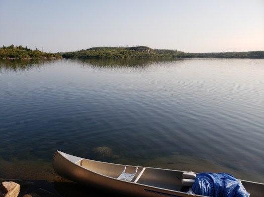
We put in at around noon that day. We hadn’t completely decided how far we would go the first day. We were on holidays for the week so we had all the extra time we wanted. We paddled south on Lower Stewart Lake to the most southern tip of the lake where we portaged into Geejay Lake. Once on the main body of Geejay, we went the Eastern tip where we could portage to Manomin Lake. At the Geejay side of this portage, there is a nice looking cabin that did not appear to have been used recently, although it was definitely being looked after.


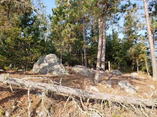
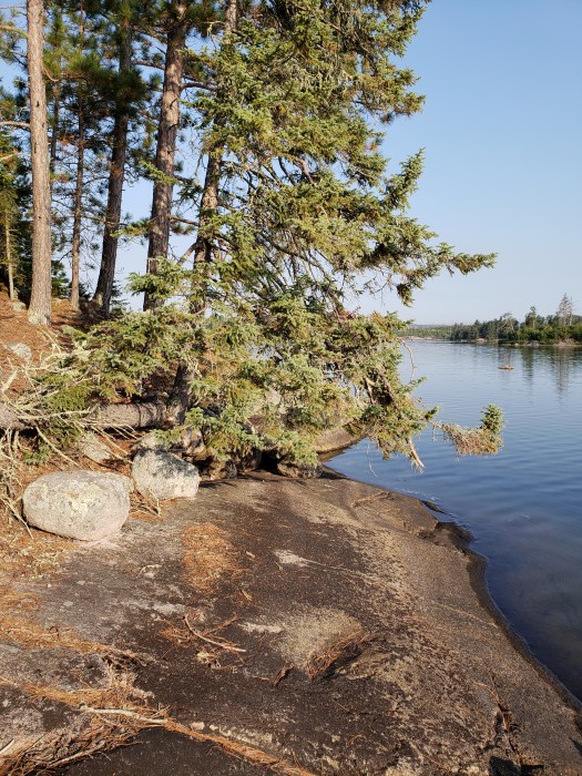
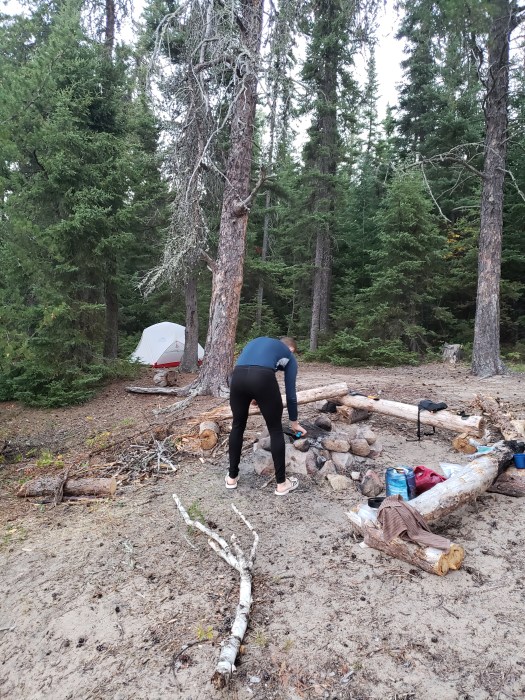
Manomin Lake had crystal clear water. We paddled across the lake to portage onto Winnange Lake along the Eagle River. Winnange’s water was just as clear as Manomin’s. The Winnange side of the portage is a sandy beach – one of many, many sandy beaches that lines the shores of Winnange Lake. We paddled south on Winnange Lake. We’d read somewhere the south basin on Winnange had been affected by a forest fire in recent years. Indeed, most of the forest along the shores here was very young and as a result, not the best place to camp. It was getting pretty late at this point, but we didn’t want to camp here so we kept going to Buzzard Falls, portaged onto the West arm of Eagle Lake and found a campsite on a small island just East of the tip of Teggau Creek. We set up camp quickly because it was getting dark – already the days in late August were getting shorter. I took some pictures here but only the next morning. We were exhausted, ate and slept well that that night.

We set off early as usual toward Teggau Creek. We wanted to check out Teggau Lake before heading back toward Crabclaw and Winnange. It was worth it – the granite cliffs of Teggau were grandiose and quite the sight.


After spending a couple hours exploring Teggau, we came back onto Eagle Lake. Eagle Lake has fishing lodges and some of the islands have private cabins that belong to the lodges. We didn’t see anyone at the cabins, but we did see a couple of fishing boats with people fishing as we headed North toward Long Bay and the portage to Crabclaw Lake.
Once on Crabclaw, we paddled Northwest where the lake ends at a beaver dam which holds up a pond. Here you have to lift the canoe over the six-foot beaver dam onto the pond. That was a fair bit of work, and the pond itself wasn’t easily navigable. The water was also stagnant and smelly. We got a few booters during this stretch.


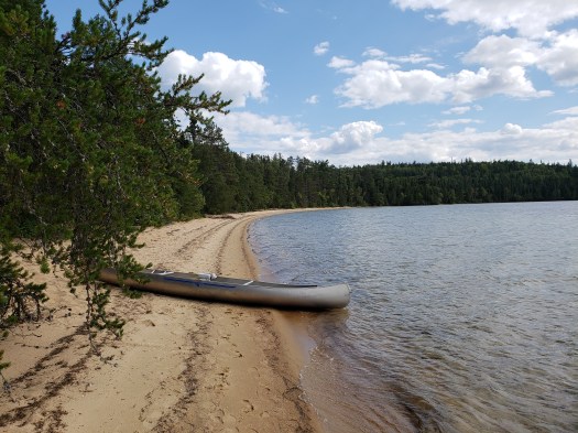
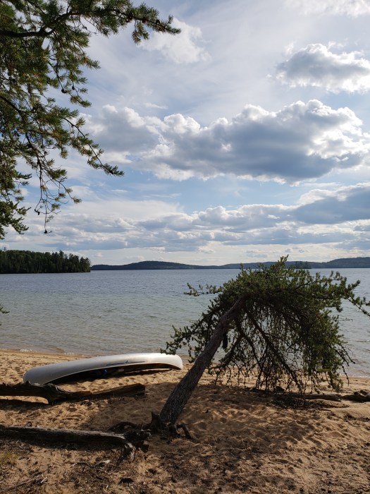
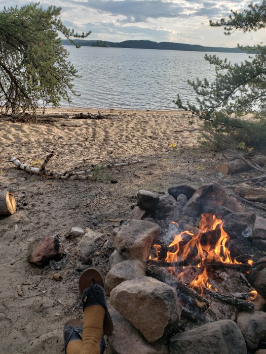
We knew we wanted to spend our second night at one of Winnange Lake’s sprawling beaches, so we were pretty excited to reach Winnange after the beaver dam and pond. Just south of the tip of land we followed from the portage was the beautiful 500-meter long sandy beach. There are several campsites along this beach (at least 3) because it is a popular spot, for obvious reasons. We arrived mid-afternoon so we could enjoy a few hours of exploring, swimming and enjoying a campfire. I highly recommend this spot – the beach is amazing and the water is crystal clear. You can be standing in shoulder-deep water and still see every detail of your toes in the sand.

The next morning we paddled on a very windy Winnange across to the northwest tip of the lake where you find the portage to Upper Stewart Lake. I’ve read this one described as the Devil’s Staircase, which I think is a very fitting description. Once on Upper Stewart we paddled through the narrows between Upper and Lower Stewart Lakes under a delapitated bridge. The water here was very shallow and we had to stand out of the canoe in order to pass. After the narrows we paddled through Railway Bay and back out to the launch site.
I have so much love for this trip. I definitely want to go back. I’m thinking this would be a good area to take our son. The beach on Winnange would make a lovely spot for a quick family overnight if we went straight there through Upper Stewart and the Devil’s Staircase. I also noticed that we had cell service the entire time. I prefer “unplugging” on these types of trips but I know my son likes camping and paddling a lot more if he can check his Snapchat at the end of the day. That’s a compromise I’m willing to make to have him come along once in a while!
There were fishing boats stored at most of the portages along this route, so the portages were very easy to find for that reason. As I mentioned above, we didn’t see any fishing boats being used except on Eagle Lake. On the other lakes the only people we came across were other paddlers, and only a few other groups.
